On March 23, 2022, members of the Centro Investigador del Sistema Acuífero de Quintana Roo AC (CINDAQ), under the auspices of the Comisión Nacional De Áreas Naturales Protegidas (CONANP), Dirección Reserva de la Biosfera Sian Ka’an and in accordance with permit CNANP-000-008, flew by helicopter from Puerto Morelos to the Sian Ka’an Biosphere Reserve with two main objectives:
- Follow-up documentation and assessment of the “Muyil-Xamach” forest fire site;
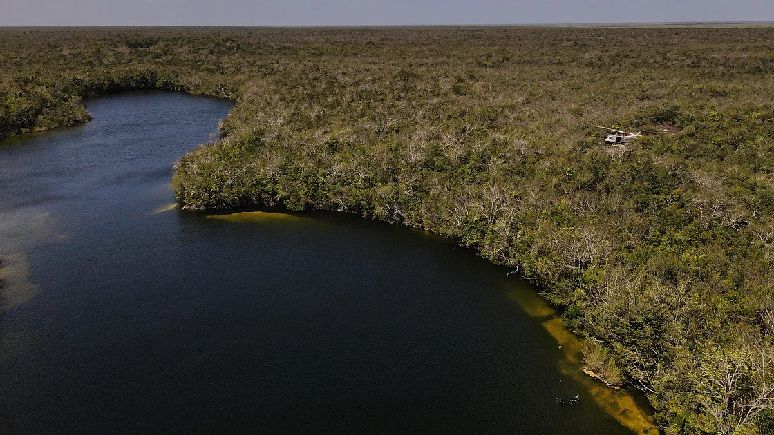
- Continued exploration, documentation and assessment of Tuun Ja cenote.
The project report can be downloaded by clicking here.
(Raw data can be provided on request.)
Map (pragmatic map showing exploration to date)
This viewport allows you to navigate, zoom in and download the map in PDF format in both English and Spanish by using the icons at the top of the frame.


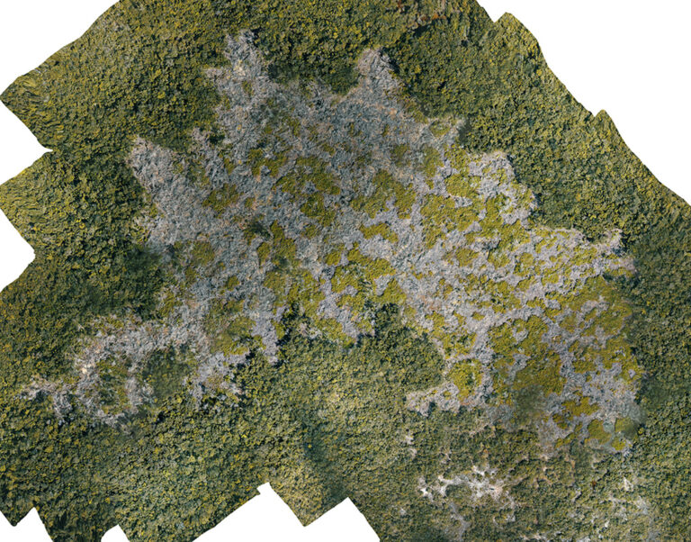
Muyil-Xamach Fire Site 3D Model
This model was generated using Drone Deploy.
Models are best viewed on a computer and not on a mobile device
360 Photo above Cenote Tuun Ja
Taken from 60m above the cenote using Drone Deploy
Muyil-Xamach Fire Site - Evolution
Comparative images of the site taken 1 year apart
 BEFORE
 AFTER
AFTERTuun Ja - Underwater video
A selection of areas on the southwest side of Tuun Ja
Muyil-Xamach - Oscar Guzman Interview
The subdirector of the reserve speaks about objectives for fire monitoring (in Spanish)