
From August 23rd to September 1st, 2023, members of the Centro Investigador del Sistema Acuífero de Quintana Roo AC (CINDAQ) at the invitation of the Casa Blanca Fishing Lodge, flew to the remote island of Punta Pájaros and the Bahía de Ascensión to investigate the presence of caves and the potential for their exploration.
Mission report can be downloaded by clicking here.
Objectives
This project had the following objectives:
- Visit and assess as many cave entrances as possible;
- Based on assessments of cave entrances, perform exploratory dives to see the potential of cave exploration in this new area;
- Document the area and its sites with drones and surface cameras to get a better idea of the landscape;
- Get to know the people, infrastructure and logistics of the island should we be permitted to return for a longer term project;
- Give a presentation to assembled guests and staff of the Playa Blanca and Casa Blanca Lodge.
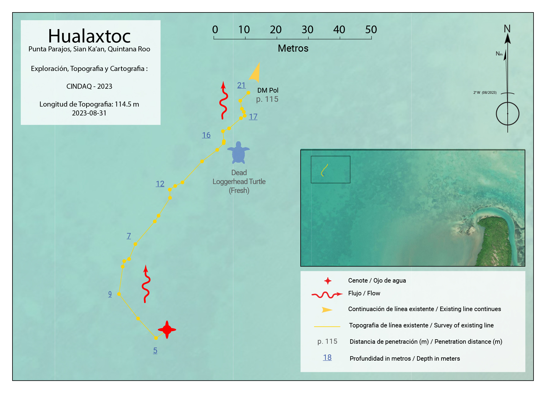
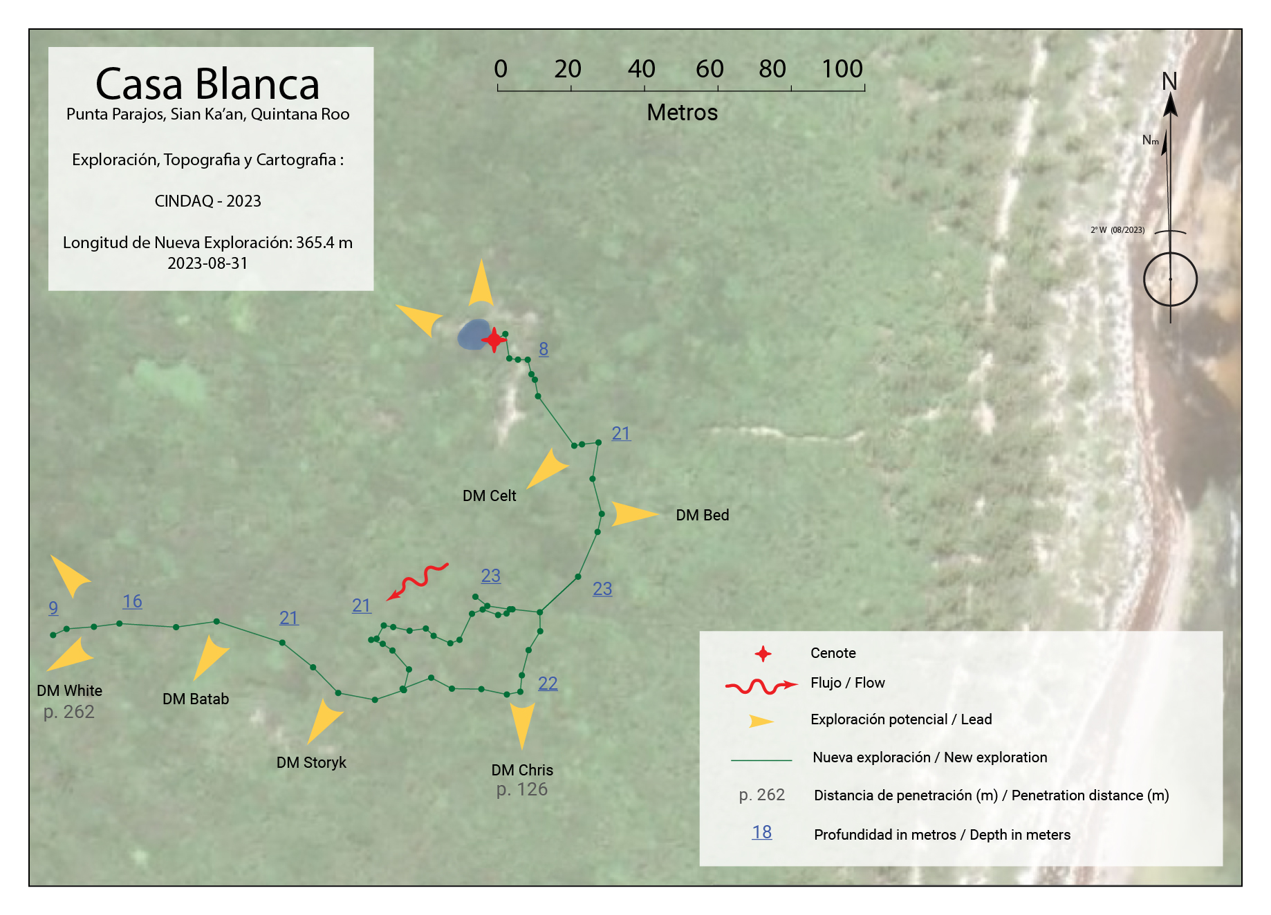
Maps


360 Photos
Photogrammetry models - Point clouds
Click on one of the buttons below to display the point clouds generated for the photogrammetry models.
Key figures
Here are some key figures for this project:
0
days on the ground
0
cenotes checked
0
models created
0
m
of cave explored
0
Gb
of data collected
0
photos taken